Pictures by Bob, Dave and John. Text by John.
If this is the kind of trip you enjoy, please get in touch. My email address is at the end of the page.
For a long time I've been doing an annual canoe trip with the same group of friends, but lately I've had the feeling that they aren't as adventurous as they used to be. Also, in the time we've been making our voyages, I've become a naturist and they haven't. So it occurred to me that I might be able to get lucky twice, and put together a naturist group to do some canoeing in locations that would be a bit more exciting than my old friends would care for.
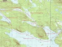
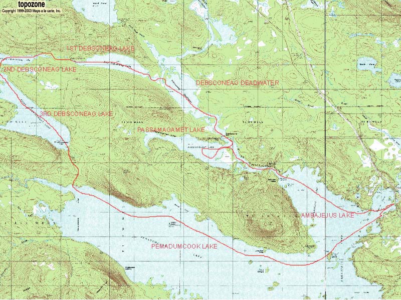
On trips with my cautious friends, I'd become somewhat familiar with the lakes and streams in the region of Maine just south of Baxter State Park, the northern terminus of the Appalachian Trail. Looking at the map, I noticed that there would be a possible trip to be made following a loop through Pemadumcook Lake, the Debsconeag Lakes (Third, Second and First) and part of the West branch of the Penobscot River, which would bring us back to Pemadumcook Lake. There would be a price to pay for this convenience, however, and that price was that we would have to make three substantial carries between lakes, of a mile each or nearly so. But even this drawback might be a benefit, if it gave us more of a "wilderness" feel, and permitted unrestricted nudity, by keeping other people away.
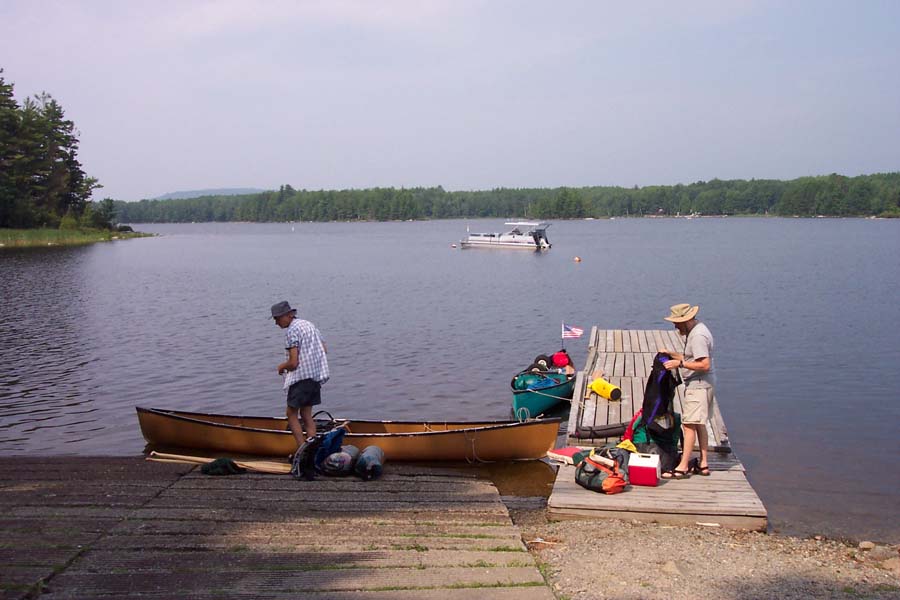
As it turned out, there were exactly the minimum number of volunteers I thought the trip needed--a total of 4 of us, allowing us to take 2 boats with a crew of 2 each. There was Joe from New York State, and Bob, Dave and myself from the Boston area. Dave was the only one I knew at all well, from various naturist hikes and activities in the past. The trip took place in early August, with Bob, Dave and myself driving to Bangor in my car, and meeting Joe at the excellent Dysart's Truckstop there. We then proceeded to Abol Bridge, just outside Baxter Park, where we camped for the night.
 |
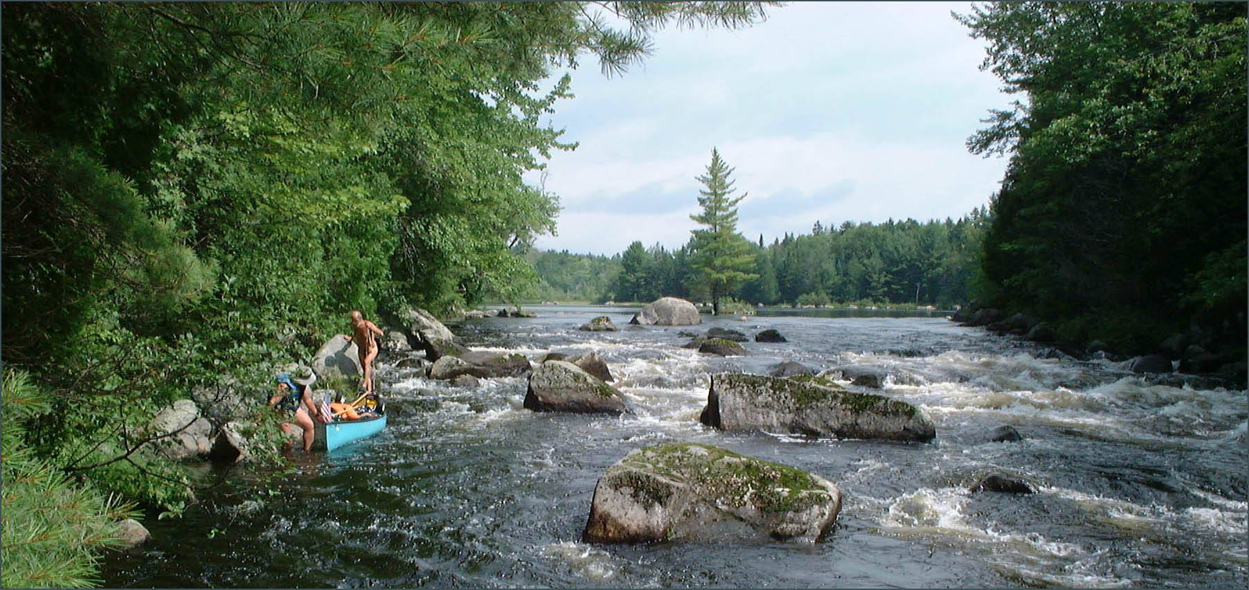
The next day was the start of our canoeing, and we began at Spencer Cove on Ambajejus Lake, which is itself just an inlet of Pemadumcook Lake. At many places in Maine dams have raised the water level so as to cause groups of lakes to merge together, originally for the convenience of loggers.
| |
|
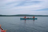
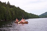
We had to start with our longest stretch of lake paddling, 9 miles down Ambajejus and Pemadumcook Lakes, and we had to do it facing west, the most likely wind direction. We were lucky and the day turned out calm.
|
 |
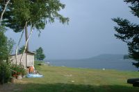 |
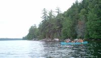
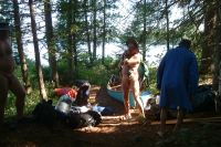
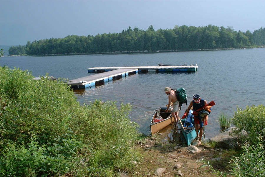
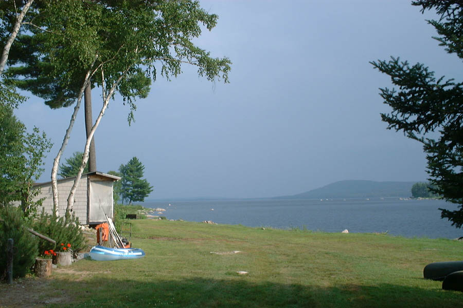
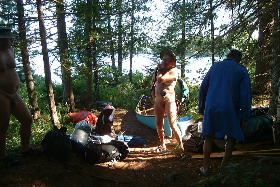
These pictures were taken on the grounds of Whitehouse Landing, a lodge at the west end of Pemadumcook Lake; this is the start of the carry trail to 3rd Debsconeag Lake. We hadn't been dressed until we approached their dock, but it seemed polite to cover up if we were going to cross their property. The ominous color of the sky made it obvious that a thunderstorm was approaching, an excellent reason to get off the water even if we hadn't just paddled the length of the lake.
By good luck, I met the owner of Whitehouse Landing and asked about the location of the campsite on 3rd Debsconeag Lake, and was told that it was "On the right side as you paddle away from the dock, uphill in a grove of pine trees."
|
|
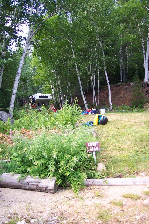
The sign says "Carry Road". The path really is a road, eroded in places but you could drive on it. It heads off uphill into the woods.
|
 |
 |
The thunderstorm arrived as we were doing the carry between Pemadumcook Lake and 3rd Debsconeag Lake, and was over by the time we launched again. Joe brought a boat cart, so he and Dave used it (this was the only time the carry trail was wide and flat enough to make it possible) and then Bob and I carried it back and repeated the journey with our boat. When we arrived at 3rd Debsconeag Lake again, Joe and Dave reported that one thunderclap had been "very loud and very close". We noticed that there was a column of smoke rising from a point in the forest across the lake, just to the left of this picture.
This is the dock on 3rd Debsconeag Lake, with Joe arranging baggage for loading into the boat.
|
|
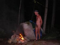
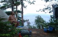
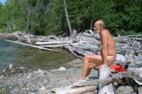
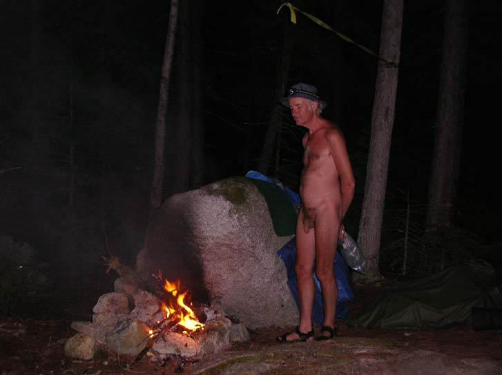
The campsite on 3rd Debsconeag Lake was indeed a little difficult to find, so the local knowledge was useful. Its atmosphere of "rustic charm" suggests that it doesn't get much use. Besides which, we arrived just as daylight was failing, so we had dinner by the romantic glow of flashlights! Fortunately there was firewood. This guy looks rather sleepy--maybe he's had a hard day.
When we arrived at the campsite we were almost directly across from the source of the smoke. For an hour or so there were flames visible in the forest, in a vertical pattern suggesting that a single tree was on fire. Eventually it went out.
|
 |
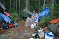 |
Morning on 3rd Debsconeag Lake, where Joe is taking some time for reading. Not having a tent, he took less time to get moving than the rest of us.
|
|
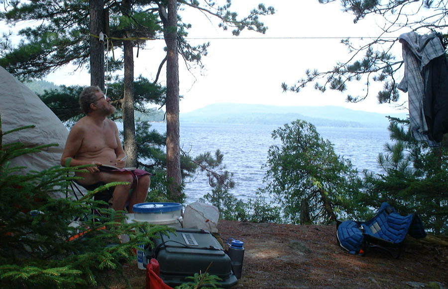
At the same time, Bob was writing his journal (and looking to heaven for inspiration).
|
 |
 |
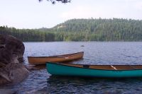
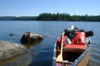
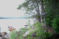
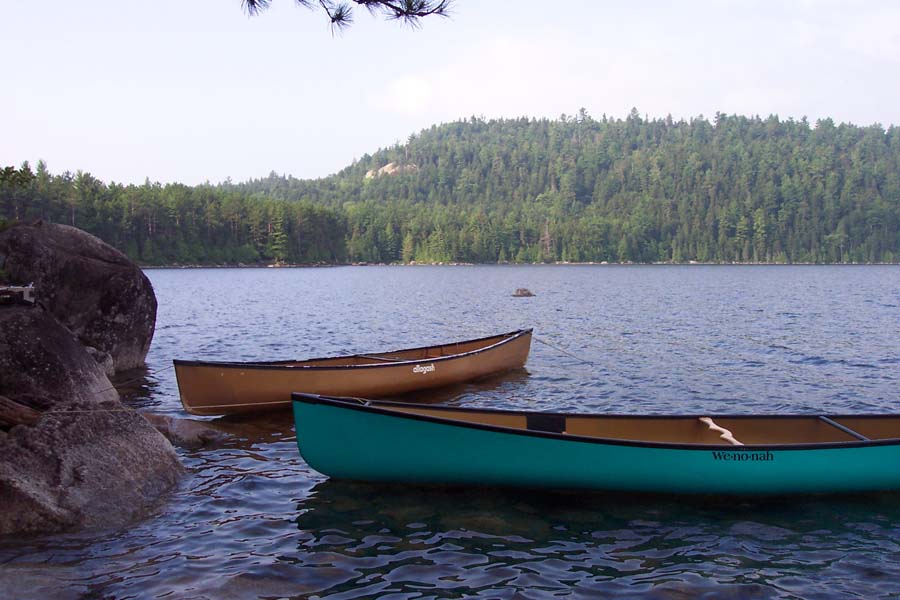
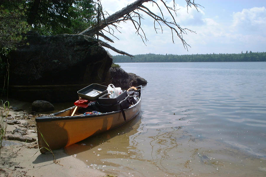
When we arrived we found that there was nowhere to haul the boats out, so we anchored them to rocks instead. This worked well until the wind came up in the morning!
|
|
A water level view of our anchorage.
|
 |
 |
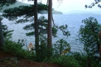
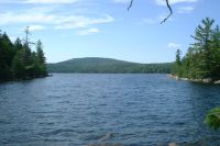
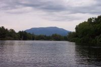
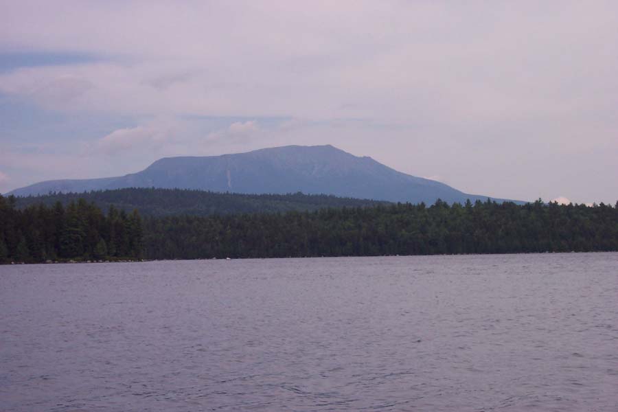
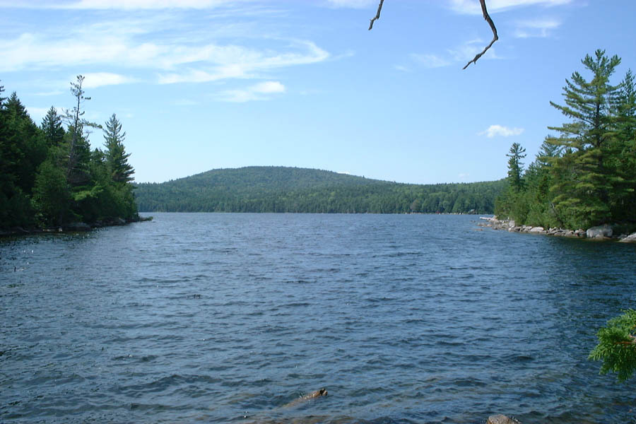
There's a view down the lake to Mt Katahdin.
|
|
Out on 3rd Debsconeag Lake, and by the time we were afloat the wind and waves were both up and dead against us. Nevertheless, we set our course for the landing where the trail for 4th Debsconeag Lake leaves the shore. In case anyone wonders, the Debsconeag Lakes are numbered up to 8, but the A.M.C. New England Canoeing Guide says that after 4th Lake "The carries become longer and the lakes smaller, so that farther travel is hardly recommended".
|
 |
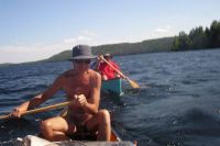 |
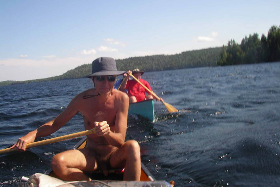
I was annoyed with Bob for taking a break from paddling to make this picture as we crossed 3rd Debsconeag Lake--with the wind against you, it's a case of "running as fast as you can to stay in the same place". But he's exactly captured the feeling of being out there with the wind blasting us and the boats tossing about. All part of the fun of canoeing, of course, even if I'm not smiling. I admit that we should have been wearing our lifejackets at this point.
|
|
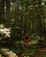
Eventually we reached the landing and became hikers.
|
 |
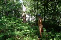 |
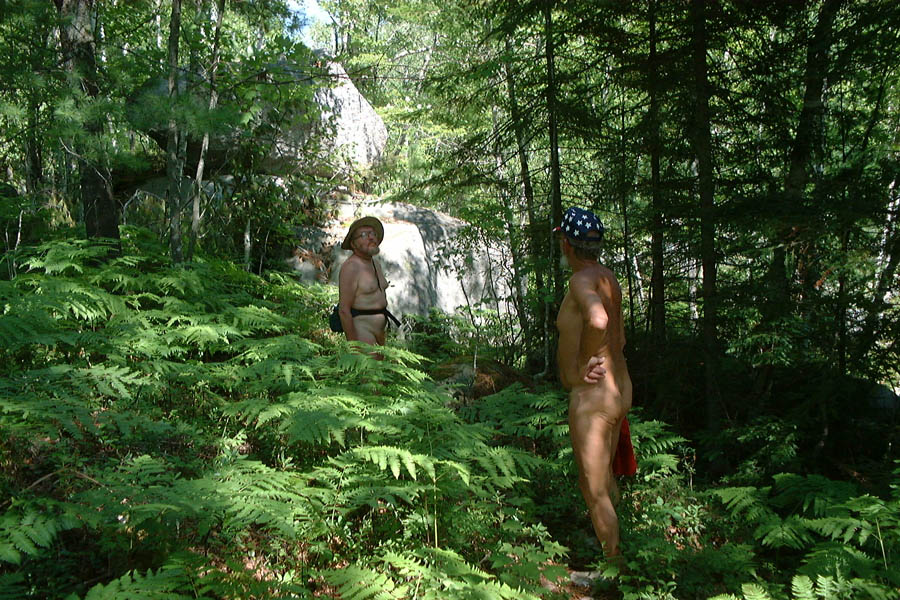
Parts of the trail might make you think you were in Eden. With four Adams and no Eve, but that's the way naturism is.
|
|
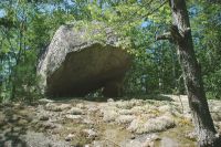
The trail took us past this big rock balanced on little ones.
|
 |
 |
It's a good thing we didn't attempt to carry boats to 4th Debsconeag Lake, because the carry trail is quite lengthy and rough, with some rocky sections and fallen trees to get over. But here's the view you get when you arrive.
|
|
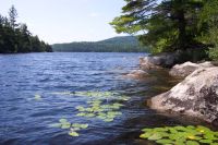
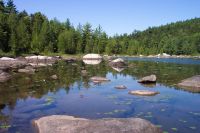
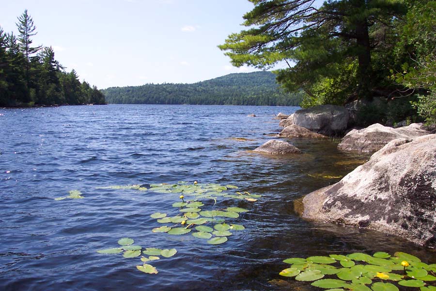
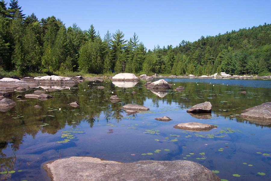
4th Debsconeag Lake is an attractive place with water lilies in the shallows.
|
 |
 |
We arrived at the east end (the downwind end) of 4th Debsconeag Lake, where all the loose floating material ends up. It makes quite a pile, and an invitation to get hurt, if you try to climb over it.
|
|
We had a swim and then started back to 3rd Debsconeag Lake. We had lunch at the landing before heading out into the wind again.
|
 |
 |
Actually there was a brief calm respite. But it didn't last!
|
|
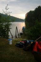
Eventually we arrived at the takeout for the carry trail to 2nd Debsconeag Lake.
|
 |
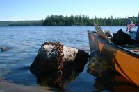 |
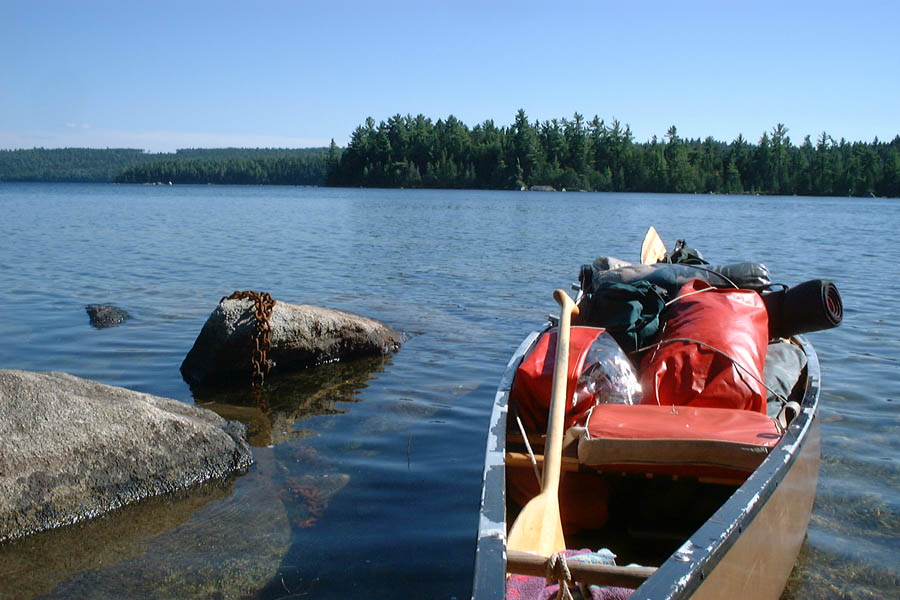
The correct spot to land wasn't immediately obvious, but someone had marked it with a piece of old chain, no doubt a relic of logging days.
|
|
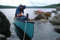
We unloaded the boats and hauled everything onto the shore, then started the carry. Bob had a lot of items to festoon himself with.
|
 |
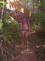 |
Even a lightweight boat is easier to carry on a pack frame. It doesn't make it possible to "dance over the trail", but it helps.
|
|
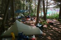
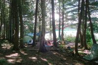
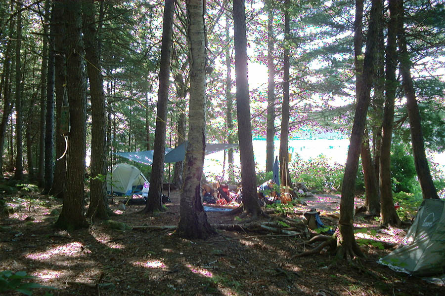
2nd Debsconeag Lake is small, but even there we had trouble with the wind. Fortunately once we reached the lake it wasn't far to the campsite, a really nice place that I remembered from a previous trip as "must visit". Somehow my camera malfunctioned while we were there.
|
 |
 |
Camera still not working right, but here's another picture of the 2nd Debsconeag Lake campsite.
|
|
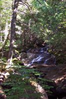
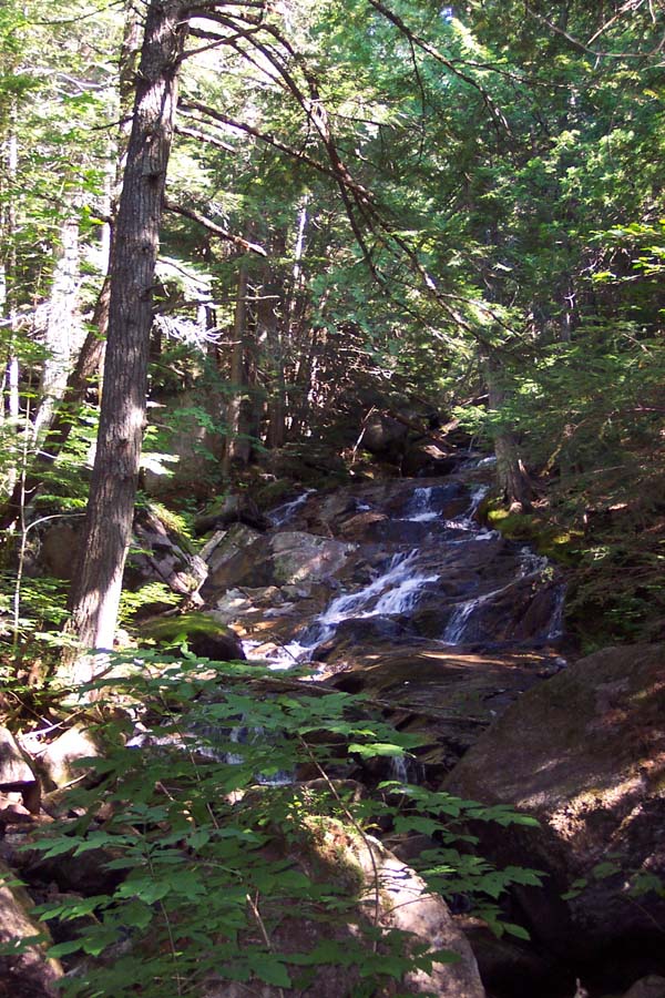
On the hillside behind our campsite this waterfall made a pleasant sound all the time.
|
 |
 |
At the east end of 2nd Debsconeag Lake it gets shallow and rocky before you reach the carry trail.
|
|
After our night at 2nd Debsconeag Lake, we did our third and last portage, to 1st Debsconeag Lake. I'd been there before, but had not known about the great tourist attraction uphill from the north shore: the Ice Caves. After some uncertainty, we found the trail.
|
 |
 |
Just as on 3rd Debsconeag Lake, there was nowhere to haul our boats out, so we resorted to using rocks as makeshift anchors.
Here you can see Joe's boat cart, which was a blessing on the first portage and just an extra burden on the others.
|
|
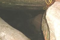
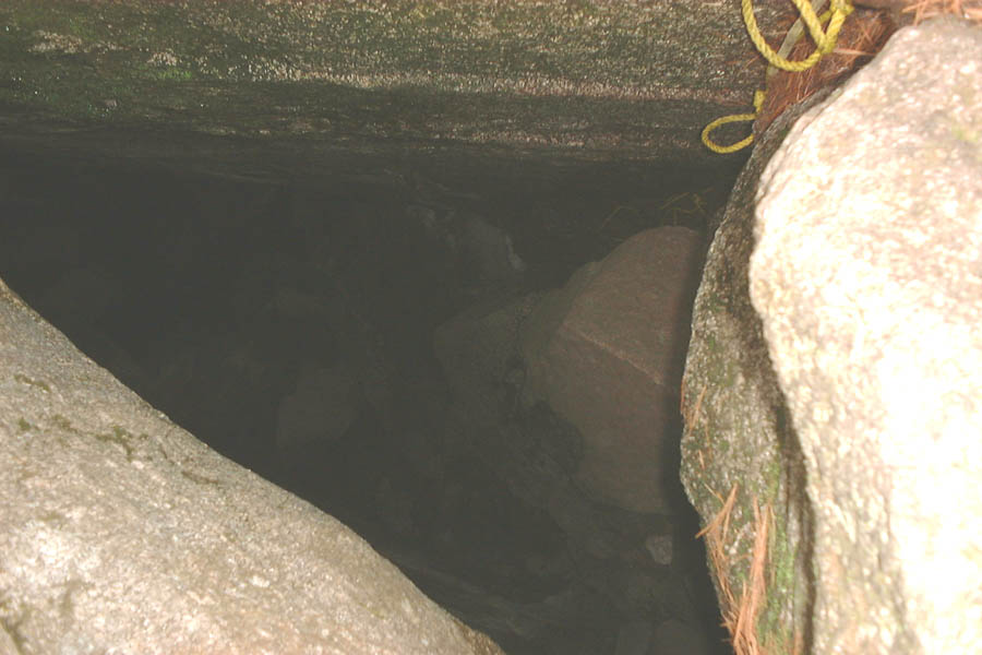
Unlike the so-called "Ice Cave" near Allagash Lake, this one really has ice in it, or at least snow. Not that there's anything really astonishing about it; it seems that snow just falls in there in winter and never melts. You can see the snow from ground level, about 12 feet down and rather dirty. Someone has installed ropes tied to nearby trees but we didn't go all the way down.
|
 |
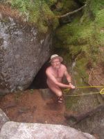 |
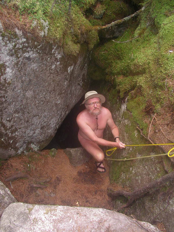
Bob emerges from the Ice Cave (not really). You could clamber down about 6 feet to a ledge from which the cave extended farther down. At that lower level you could feel the clammy air coming from the cave, as though you were climbing down into a bath of cold water.
|
|
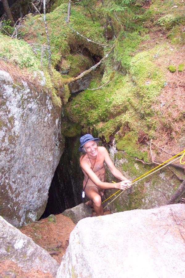
I went down there too. There may have been more than one Ice Cave. The sign said "Caves" and the trail continued, but we turned back after the first cave, not having found it excessively exciting.
|
 |
 |
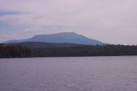
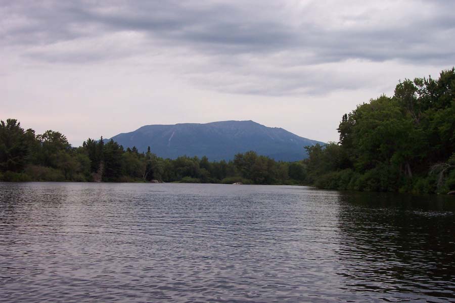
From 1st Debsconeag Lake we paddled out to the Penobscot River, at a place called the Debsconeag Deadwater. This was where we made our closest approach to Mt Katahdin.
|
|
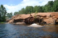
At the side of the Debsconeag Deadwater there's a large beach where we camped for our last night. Then we resumed our journey and passed two rapids, of which this was definitely the more fearsome: Passamagamet Falls. The river is divided by an island and we took the course with less water, and lined our boats down the side.
|
 |
 |
Just at the foot of Passamagamet Falls is Passamagamet Lake, which we entered with the idea of finding a quiet spot for lunch and a swim. We found a nice place, but after lunch the wind got up in a direction that blew us back to the river. More exploration of the lake would have meant fighting it, and everyone said we'd done enough of that.
|
|
The river led us back to Ambajejus Lake, and we followed the north shore back to Spencer Cove, with yet more wind and waves to contend with--this time a crosswind, to make life more interesting. Along the way we passed this bizarre object, a huge pile of sawdust. You'd think it would rot away quickly, but apparently a large mass of sawdust can last for decades.
And so the trip ended. Those of us heading for Boston got home that night.
|
 |